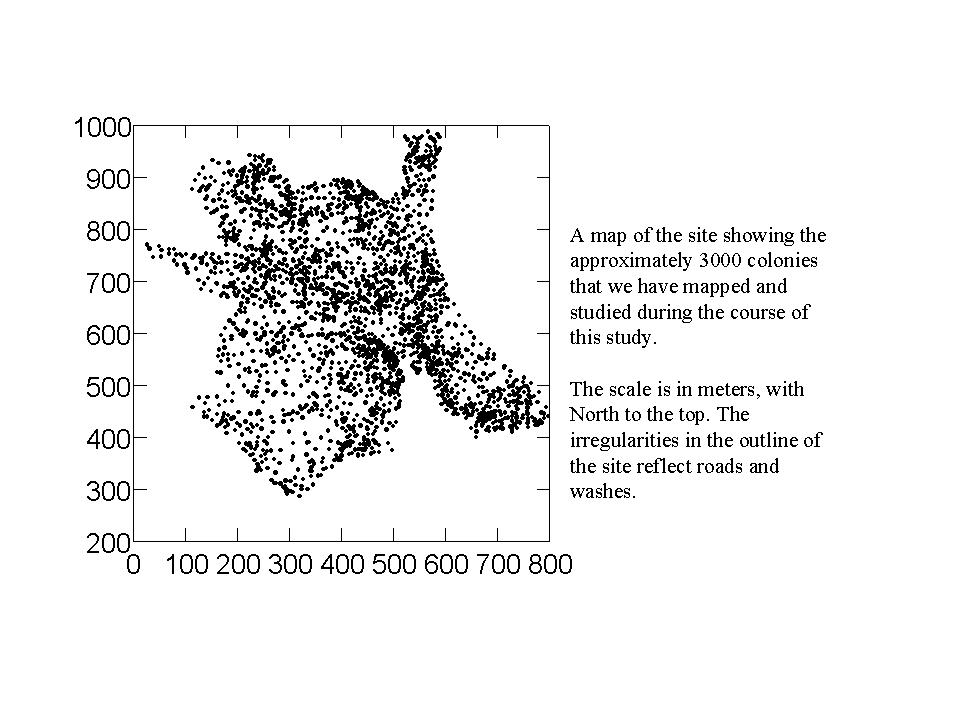
A map of the study site showing the location of Pogonomyrmex occidentalis colonies
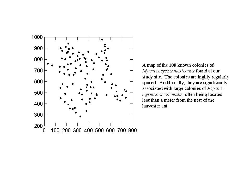
A map showing the location of Myrmecocystus mexicanus colonies
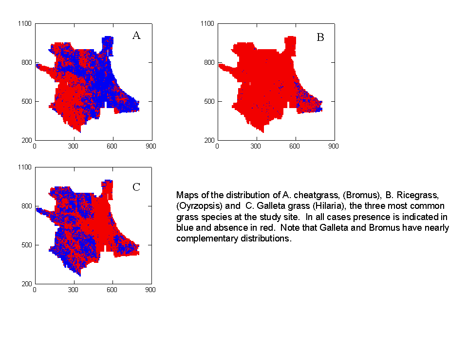
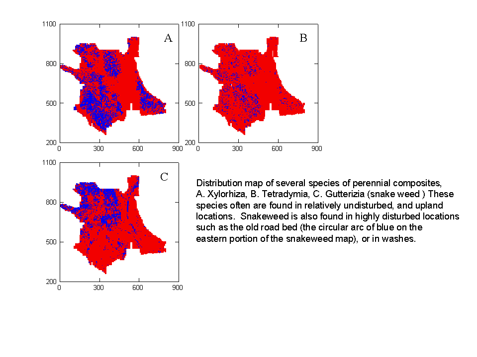
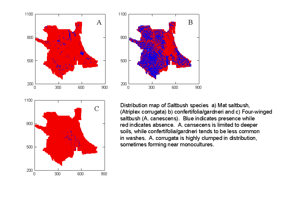
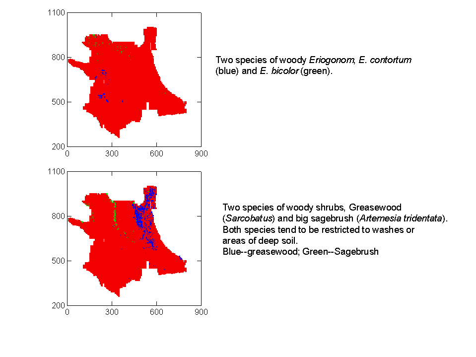
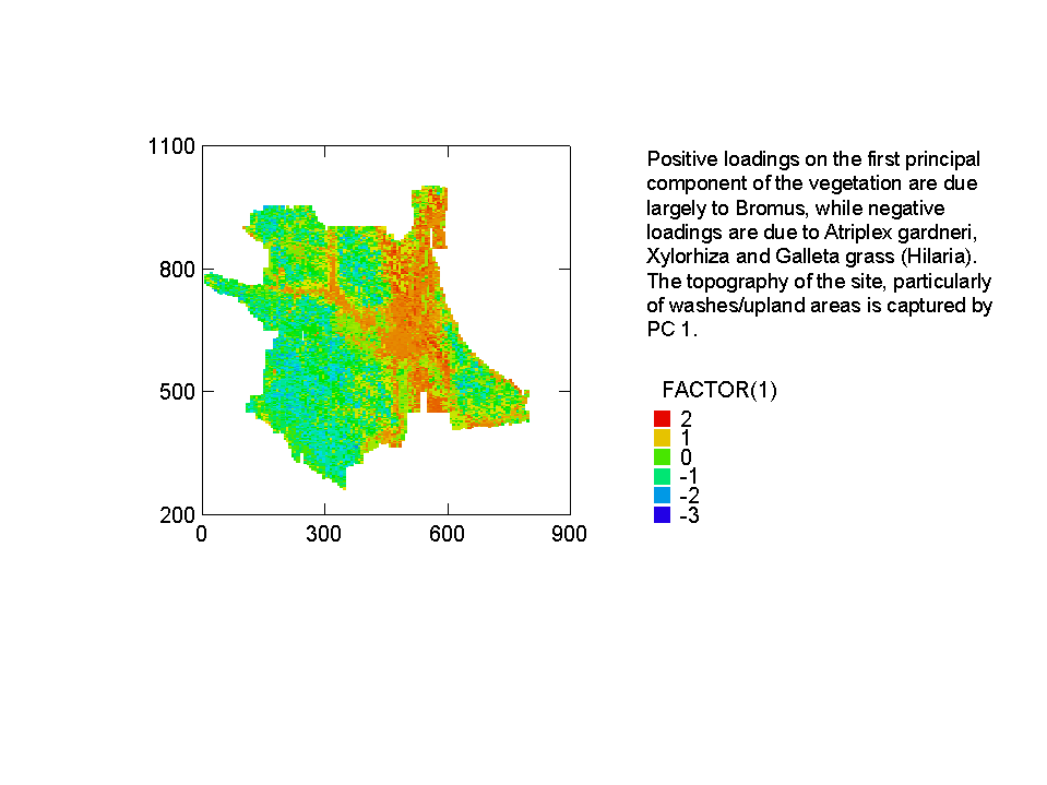
The following are a set of maps of the vegetation of the site.
Each map represents the vegetation at 14,592 1m x 1m plots spaced evenly throughout the study area.
A map of the small woody composites
A map of woody Eriogonums and Large Shrubs
A map of the first principal component of vegetation.
This link leads to a set of
vegetation maps for particular species (This is a big file and links
to other large files. These files are in wmf format. It is possible
to save them to a file [right click the box] and then insert them into a
PowerPoint slide)